Rivers & Creeks
There are three river catchments located within the Noosa Shire Council area, with Noosa River catchment being the largest, occupying nearly two-thirds of the Shire.
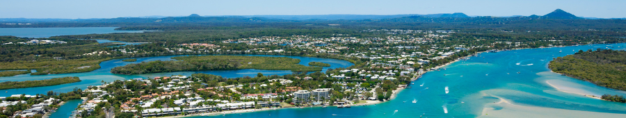
The Noosa River flows south from the Cooloola Section of the Great Sandy National Park into Laguna Bay. It is fed by springs that drain major sand deposits and is one of the few Queensland Rivers with a continuous year-round freshwater inflow.
A number of the Mary River tributaries are located in the hinterland regions of Noosa Shire. Six Mile Creek is the largest of these and Lake Macdonald is the impounded reservoir of the Six Mile Creek Dam, which forms part of South East Queensland's drinking water supply. These creeks flow into the Mary River and north to Hervey Bay.
Tributaries of the Maroochy River catchment are found in the southern parts of the Shire near Lake Weyba. These are the headwaters of Doonan Creek and the northern arm of Stumers Creek. Both these creeks flow south from the Noosa border.
Statistics and Facts
- Noosa Shire Council area 869.8km2
- Noosa River catchment covers 63% of the Noosa Shire
- Mary River catchment covers 36%
- Maroochy River catchment covers 1%
- Map of the rivers and creeks within the Noosa Shire area
Management of Rivers and Creeks
The table below provides a summary of common issues concerning the management of waterways.
| Topic | Management Agency | Contact Details |
|---|---|---|
|
Noosa River Foreshore Management
|
Noosa Council | Customer Service Centre (07) 5329 6500 (including After Hours emergencies) |
|
Wildlife Management
|
1300 ANIMAL
|
|
|
Interference with a Watercourse (freshwater)
|
Department of Regional Development, Manufacturing and Water |
(07) 3328 4811 or 13 74 68 |
|
Interference with Tidal Lands
|
Noosa Council | Customer Service Centre (07) 5329 6500 (including After Hours emergencies) |
|
Vessel Management
|
Shop 4 Email: MSQNoosa@tmr.qld.gov.au |
|
|
Australian Maritime Safety Authority (AMSA) National Regulator for Domestic Commercial Vessels (DCV) |
1800 627 484 |
|
Fisheries Management
|
Tewantin office |
|
|
Noosa Council | Customer Service Centre (07) 5329 6500 (including After Hours emergencies) |
The following community-based organisations also have key roles to play in the management of our waterways.
| Topic | Community Agency | Contact Details |
|---|---|---|
|
Water Quality Monitoring and Catchment Management |
||
|
Noosa River |
52 Doonella Street, Tewantin |
|
|
Upper Noosa River / Kin Kin Creek |
Station Street, Pomona |
|
| Mary River Catchment (Six Mile Creek) | Mary River Catchment Coordinating Committee |
25 Stewart Tce, Gympie |
|
Vessel Management
|
Australian Volunteer Coastguard QF5 Noosa |
Munna Point, Noosaville |