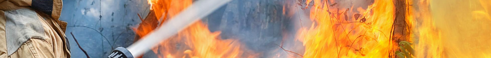
Fire Management
Noosa Council currently has management responsibilities for 178 Bushland Reserves (public areas managed primarily for conservation) that cover a total of 3,469ha. Council Bushland Reserve represents less than 4% of all land in Noosa, with significant larger portions of native habitat present in National Park and on private land.
There are a number of key actions Council undertakes to mitigate the fire risk inherent in bushland areas and reserves – implementation of fuel reduction zones, weed management and bushland management, creation of fire access trails, and undertaking controlled burns. Every reserve is different and not all actions are suitable for each one.
The Bushland Reserve Fire Management Plan (FMP) identifies the highest priority reserves for bushfire mitigation works. The updated FMP was endorsed on the 17th June 2021 including changes in relation to climate change and the longer and more intense bushfire seasons we are likely to experience as a result.
Fire access trails & Fuel reduction zones
Fire access trails within Council-managed Bushland Reserves make up a total length of 62km and provide access for fire appliances (vehicles) for the purposes of controlling fire.
Fire trails are not intended to be ‘fire breaks’ that provide a complete barrier between fire and properties, but are designed for access by emergency services to protect life and property. The width and type of the fire trail depends on topography and requirements for a safe separation between fire crews and vegetation. In some areas it is not possible to provide a clear break, such as steep slopes, and in these cases fuel reduction will be undertaken instead.
Fuel reduction zones are defined as areas in which fuel levels have been reduced for the prime role of reducing wildfire intensity. Fuel reduction zones are generally used when a reserve is deemed not able to safely conduct planned burn activities or when a functional fire trail is not able to be established, for example on steeply sloping land.
Planned burning
Council currently undertakes some planned burns within its bushland reserves. These are prioritised using the State Planning Policy Potential Bushfire Intensity (PBI) mapping which identifies bushfire prone areas across the Queensland. The CSIRO developed the methodology for the fire hazard mapping based on vegetation type, fuel load, slope and fire weather severity. The mapping identifies areas of medium, high and very high fire hazard, and fire management actions are prioritised accordingly.
Council staff work closely with other land managers when it comes to fire mitigation, especially the Queensland Parks & Wildlife Service (QPWS) who undertake most of the planned burns within the Noosa Shire.
Planned burns are completed by suitably qualified contractors and are required to be performed in accordance with the Australasian Fire and Emergency Service Authorities Council, Department of Environment & Science Planned Burn Guidelines and SEQ Fire & Biodiversity Consortium Fire Management Operations Manual.